| | ||||
|
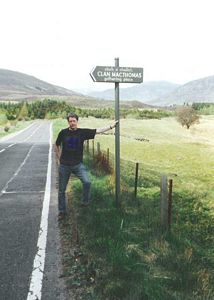
Lochnagar (Cac Carn Beag) Carn a' Choire Boidheach (White Mounth) Carn an t-Sagairt Mor Cairn Bannoch Broad Cairn Map Yesterday, having stayed the previous night at my mother's, I picked up Andrew from Ramsbottom and we drove from there up to Ballater . It was a nice sunny day and we left the M6/A74M after Moffat and drove along the A701, a fine empty road. We passed the Source of the Tweed - it's not a dripping tap. It starts in a small bowl-shaped depression between a couple of hills; there's a boggy bit in the middle and out of the lower end of this comes a small trickle of water which ultimately becomes the mighty River Tweed. About 14 miles south of Braemar we drove past a sign by the side of the road - absolutely in the middle of nowhere - which announced: 'Gathering Place of the Clan MacThomas'. If you get out of the car, go through a gate and through some trees you come to a small clearing where there is a large rock, about 6ft high and 25ft around. Complete with a plaque stuck on it - by a yank of course. He wasn't even called Thomas - McCombie from California. Anyway according to him generations of noble Thomases, MacThomases, McCallums (a variant apparently) and the like had swarmed and spawned on this very spot! A stirring thought.
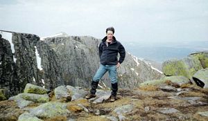
We stayed in Ballater at a B&B called 'Celicall' which had a stone in the garden patio inscribed 'Police Station 1860'. Had a nice meal in the Alexandra Hotel - mushroom & chestnut parcel with stout & stilton in it, plus chips & salad. Very tasty (£5.90). Andrew was on some medication and said he didn't want to drink much so he had halves while I had pints. Of course he still guzzled it down at the same alarming speed as usual so I ended up struggling to keep up. After the Alexandra Hotel we went in the Monaltire Hotel, the Gleneaden Hotel, the Prince of Wales, the Coach House (young clientele/loud music) and back to the Prince of Wales again. The barmaid in the Monaltire was a Russian lass and there were some yanks in the bar - MacThomases to a man, no doubt! In the Prince of Wales we had a game of darts - the usual 'cricket'. It ended up 184:182 with both of us needing a bull. Eventually after dozens of goes each we gave up and had one dart each to get nearest the bull. Andrew won. A great day of blue skies and occasional white clouds floating slowly by - perfect. We drove about 10 miles down the road from Ballater along Glen Muick to the delightfully named Spittal of Glenmuick where we parked the car and set off at 10.05. It was over 5 miles to get to Lochnagar - gentle ascent mostly with just the odd steeper bit. There was still a lot of snow at the top though, melting now with the warm weather, and a lot of run-off water was filling up the streams. At the top of Lochnagar there's a cairn, a trig point and a view indicator which was set up in the 1920s - showing what each hill you can see is, its name and distance. It reckoned that on a clear day you should be able to see the Cheviot, 113 miles away in England. Well the weather was OK but I couldn't see the Cheviot - I think eyes must have been keener in the 1920s, or skies clearer. Great views from there though, in every direction.
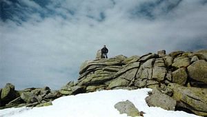
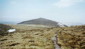
And here is the last verse of Lord Byron's poem: Years have roll'd on, Loch na Garr, since I left you, Years must elapse ere I tread you again; Nature of verdure and flow'rs has bereft you, Yet still you are dearer than Albion's plain. England! Thy beauties are tame and domestic To one who has roved o'er the mountains afar; Oh for the crags that are wild and majestic! The steep frowning glories of dark Loch na Garr. We carried on a mile or so to the next hill, the White Mounth (so called because of the white/light-grey rock granules about the size of a small pea lying all over the ground which presumably give it a whitish look from a distance. Not so obvious on the day - maybe the snowy bits lessened the impact). A very easy, rounded summit with not much ascent necessary at all. At this point Andrew reckoned he'd come far enough as we had a 7 or 8 mile trek back. Reluctantly I agreed to turn back but he then suggested I carry on as he knew I really wanted to. I knew it was the wrong thing to do but did it anyway. The next hill was about another mile away - Carn an t-Sagairt Mor - and again only involved a few hundred metres descent and ascent. I said we could cop it and then follow the stream, the 'Allt an Dubh-loch', down to Loch Muick and pick up the path again there. Andrew pointed out there was no path marked on the map that way & reckoned it'd be a 2 mile bog. He turned back and I set off. Where the two hills met there was a stream, swollen with the run-off melting snow and it looked awkward to get across. Two other walkers were faffing about trying to get across lower down so I turned upstream to look for a crossing point. There the stream was completely covered with snow but in one place the snow had fallen in to leave a large hole and you could see the stream belting along underneath. Across the snow led a trail of footprints so someone had obviously been able to walk over the snow 'bridge' earlier. It was a bit disconcerting as you didn't know exactly where the stream was, and there were also a couple of ominous cracks in the snow, but I carefully, very gingerly, edged my way across, following the prints… All OK, dunno why I worried. Further down the two faffers were finally getting across but I'd overtaken them and set off ahead of them up the mountainside. More snow there and I had to edge up a large bank of it on the way to the top. There was some aircraft wreckage there, very near the top so the plane had nearly made it - but not quite. I sat and had a banana and wondered where the faffers had gone and what to do next. Looking down the Allt an Dubh-loch at the intended path back I saw Andrew was right - a boggy morass swollen with the melted snow. I didn't fancy that much so set off for the next Munro instead, another mile away, to cop that and consider the options from there. I saw the faffers ahead of me heading in the same direction - they'd skipped the hill out! Shocking. I caught up with them by the next peak (Cairn Bannoch) - easy again - but they sidestepped this too and retook the lead. That was four Munros done and I was now committed to doing the whole 20 mile/5 peak circuit - tried to pretend I'd done the bulk of it.
I carried on to the next and last peak (Broad Cairn) - this was a bit more distinctive than the previous three which had all been pretty easy, gentle and unremarkable though with nice views. It was straightforward enough though - a fairly regular, squat cone shape with a rocky, granite summit. I overtook the faffers and got to the top. They couldn't bypass this one so I met up with them at the top and chatted a bit. Good lads really, they'd actually done all the peaks before and were just doing the circuit today as a walk because they liked the route. I left them behind and set off along a good, high-level track following the heights around the southern side of Loch Muick - there is an alternative lakeside path but the faffers had told me it was a bit claustrophobic and always in the shade and I was happy with the high-level option. It gave a good view across the loch to Lochnagar where some impressive waterfalls were pouring off the mountain. I made good progress from there on. Halfway along the loch the path dropped down in steep zigzags to the valley bottom and from there it was an easy walk back to the car park. I made good time and got back 18.40, about 10 mins after Andrew. Stayed the night in Braemar - I hadn't been there since 1990 when we did Ben Mcdui. There are only two pubs there - the Fife Arms Hotel and the Invercauld Arms Hotel. The latter had the normal hotel type lounge bar but also a seedy public bar in a separate building. Andrew naturally headed for this (strangely half-pint measures seemed to have slipped his mind this night). Had a game of crib but history has forgotten who won. | ||||

 | ||||


