| | |||||
|
Binnein Beag
Map Trisha drove me to the familiar car park at the end of Glen Nevis and I was on my way by 7.50, hoping to squeeze in this hill, the last of my unclimbed Mamores, before the forecast rain arrived. The day was overcast and the tops were in and out of cloud but as it happened the rain never did arrive - only a few light spots at the summit and that was just the normal middle-of-a-cloud stuff really.
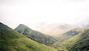
I passed through the wooded gorge section and then continued along Glen Nevis for about 3.5 miles in all before reaching my destination. As I approached Binnein Beag - which appeared as a fairly regular shaped cone on the right-hand-side of the valley - I impatiently tried to take a short-cut by following a path which led south along a stream. This didn't work out too well though - they seldom do - and I ended up angling across rough grass and bog to get to the correct starting point for the ascent.
Once I was across the river the terrain was initially grassy and steep, then heathery and steep, and finally scree and boulders and steep. There wasn't much sign of a path either so I just headed directly upwards. The scree in the higher sections was rather unstable and it became a hard slog but I bashed on and eventually gained the top at 10.40.
There was nothing to see when I got there for the top was covered in light cloud. A windbreak and a cairn sit side by side on the barren, stony summit platform and a path continues south in the direction of Binnein Mor. I'd already done that one, however, so today I just took a photo and then turned back. A quick drop down the hill - there were some vestiges of a path at first but they soon disappeared - was followed by the long trek back to the car park which I reached at 12.50. | |||||

 | |||||
