Day 13
Friday 1st June 2012
Langdon Beck to Dufton
Breakfast at the farm was served up mostly by the farmer. He was affable enough but I
felt a bit wary of him - I suppose I didn't trust him because of the female sobbing
I'd heard the night before. His missus appeared and gave me my poached
eggs - I didn't hear her say
a word to her husband that morning. I ate quickly, ignoring the prize collection
of dead flies on the dining room window ledge, and had a mug and a half of tea.
Coffee wasn't offered and nor was toast although I expect I'd have got both if
I'd asked. The teapot was enormous and full - god knows who they think would
drink two pints of tea before setting off. The farmer had a packed lunch for me
- horrible white bread for the sandwiches but otherwise ok. He charged £5 for it
plus the £30 for the night and after I'd paid up I was away by 8.43, glad to
leave and absolutely certain I'd never be back there again.
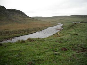 Continuing along the River Tees
 |
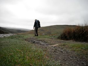 Fare well, Langdon
 |
The day was damp and misty but it wasn't actually raining and slowly things
cleared and brightened up - it was quite nice by the time I got to Dufton. It
was all fairly level going, following the course of the Tees for a good while.
I came to Cauldron Snout where the water released from Cow Green Reservoir comes
boiling and crashing down a narrow and rocky gorge, very scenic and spectacular.
You have to climb up the side of this gorge to the top where a bridge takes you
across to the other side. It was a bit dodgy climbing up the rocks with a 30lb
pack on my back and I took it very carefully, using knees occasionally; of course
when I reached the top I inevitably found the correct path which would have taken
me there much more safely. Not to worry, I'd survived so all was well.
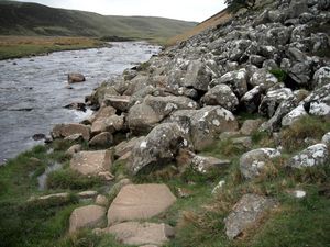 Boulders across the path
 |
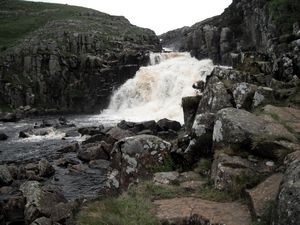 Cauldron Snout
 |
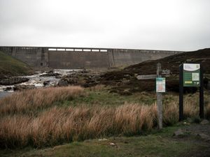 Cow Green Reservoir Dam
 |
I carried on along the river, clambering over the occasional boulder fall, and
eventually left it behind, climbing gently over neatly sheep-cropped grass till
I came out on the spectacular rim of High Cup Nick, a very symmetrical valley
carved out of the rock by the glaciers of the Ice Age, I'm told. I stopped there
for a sandwich and to appreciate the view for a while. Then I carried on along
the northern edge of the 'cup' and over some ensuing heathland before dropping
down in a long, gradual descent to Dufton.
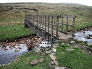 Footbridge over the Tees
 |
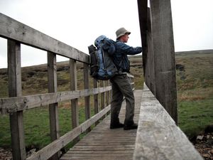 Me on the bridge
 |
At Dufton I called in at the only pub, the Stag Inn on the village green, for a
pint of shandy only to learn that there would be no meals available there that
evening as the pub's new owners were putting on an 'open house' event to introduce
themselves to the locals. I got the number of a taxi so I could go somewhere
further to eat then ambled about ½ mile out of the village to the B&B I'd booked
myself into - Coney Garth.
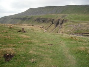 The approach to High Cup Nick
 |
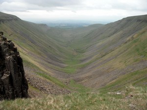 High Cup Nick
 |
It looked farm-like but fortunately not like the farm I'd just left.
Not plastered with shit everywhere for a start. The owner kindly offered to do me
a microwaved macaroni to save me having to travel to the next village to eat.
After some time she brought it all round to my room along with a drink of Schloer
and an arctic roll for afters. Very nice. I didn't know what I'd be charged for
all this as she was doing my washing for me and making me a packed lunch for
tomorrow as well. Still, it was a much nicer place than the one from the previous
night and she was a very pleasant lady; I didn't think she was the type to
overcharge me.
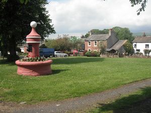 Dufton
 |
I rang the Youth Hostel at Alston and booked myself in for the next day, a day
which would be the toughest so far covering 20 miles and three major hills, one
of which, Cross Fell, was the highest point of the Pennine Way, at 2930 feet.
Because it was such a hard stretch I rang a baggage transport company I'd heard
of, Brigantes, to see if they could take the bulk of my luggage to Alston but
they reckoned it wouldn't be economic for them so I resigned myself to the prospect
of lugging it all the way myself. It was going to be a long day.
Trisha sounded ok when I spoke to her but said she'd have to go for a PET scan
in a couple of weeks - after our forthcoming Isle of Man holiday - to check
something on her rib. A bit worrying but I tried not to show that.
Distance: 14.6 miles
Average speed: 2.4 mph
Total ascent: 2096 feet
Total Distance: 174.44 miles
|
