Day 19
Thursday 7th June 2012
Byrness to Windy Gyle
The penultimate day!
Good walking weather to start with, cloud cover and a nice temperature, not hot
or cold, little breeze.
I left Byrness quite early, at 8.15, having arranged with Katie, the hotel owner,
to be picked up at Trows, a disused farm about a mile and a half to two miles from
Windy Gyle. The latter is a middling-sized peak about halfway along the Byrness
- Kirk Yetholm stretch (about 13 miles). Katie was going to fetch me back to the
hotel for another night in comfort instead of sleeping in the 18-Mile bothy, and
then take me back to Trows the next morning so I could carry on from there. The
other great benefit of this arrangement, of course, was that I could leave most
of my luggage at the hotel and not have to carry it on my back up the hills.
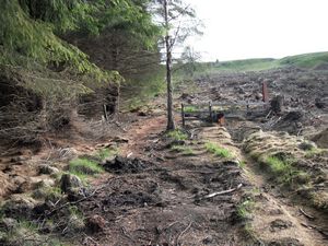 Climbing Byrness Hill
 |
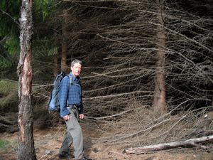 on the edge of the forested area
 |
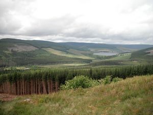 Up into open country,
nearing the top of Byrness Hill |
On leaving Byrness there was an immediate steep pull up the hillside to reach the
top of Byrness Hill, then the main character of the walk appeared - a high level
walk with views far and wide of rolling hills and empty landscapes. Gentle ups
and downs with some very boggy sections and some stretches of paving slabs. At
one point about three quarters of the way along today's route I came across some
wild goats but I didn't bother them and they didn't bother me.
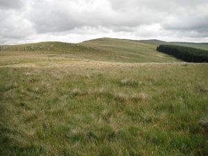 Onto the ridge - open, rolling countryside
 |
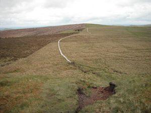 Paved section of path over boggy bits
 |
It got slightly breezier and I put the shell jacket on. Still ok though, then a
few light drops of rain began to fall as I approached Windy Gyle - not much though,
not enough to get me properly wet. I didn't see Dave today - I expect he left early
- or the couple from the Bellingham pub, or the trio who had been staying in the
hotel last night. The latter were aiming for one long yomp to get to Kirk Yetholm
that day, and the girl had been twittering about how they must do the Cheviot
extension too. I wondered if she'd still feel the same way when she got to it as
it adds an hour or more to get to the top and back. Personally I'd done the Cheviot
already, back in 1996, and didn't intend doing it again on this trip. I did meet
a couple of lads from Newcastle coming the opposite way though and stopped to chat
with them for a while.
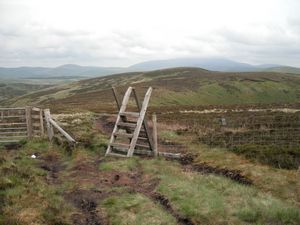 Further along the ridge
 |
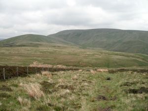 A distant Windy Gyle
 |
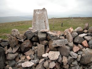 The trig point on Windy Gyle summit
|
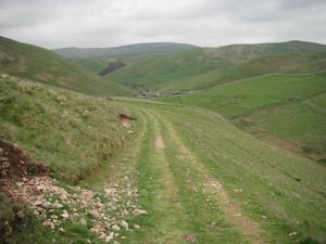 The track leading down to Trows
(ie the couple of buildings you
can see in the distance) |
I was at Windy Gyle by 2.15 and left the top at 2.23, heading down a well-marked
track to Trows. It was 3.05 when I got there and I then had to hang around reading
the book Les had given me (the Middle-Aged Mountaineer by James Curran) until Katie
turned up in the Landrover to take me back to the hotel. She was due at 4.30 so
I had a long wait and got a bit chilly, sitting in a sort of open storage barn.
She was five minutes late.
Distance: 15.2 miles (of which 2.1 mile was the trek down from the PW to Trows Farm)
Average speed: 2.7 mph
Total ascent: 3139 feet
Total Distance: 268.64 miles
|
