| | ||||
|
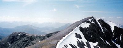
Stob a' Choire Mheadhoin Stob Coire Easain Map I had been planning to do the Grey Corries today but found the usual approach from Corriechoillie barred because of the Foot and Mouth precautions and I thought doing them from Fersit was a bit much. Instead I decided to drive to Fersit and do these two hills. It was a very hot morning with clear blue skies, very hazy and no wind. I set off along a landrover track at 9:50 and then just a bit past the dam on Loch Treig took to a path leading upwards. It was easy going at first and after about 50 minutes I reached a very large trig point standing on the hillside - not located at the top which was a bit unusual. From the trig point there was a horribly steep and slightly dodgy scramble up a bluff called Meall Cian Dearg, followed by a flattish stretch which was well stocked with annoying flies and lots of green bugs. Slowly ascending after that, over grass and stone, I eventually reached the rounded top with its cairn.
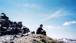
Conveniently there was a bloke there to take my picture - the first person I'd seen on the hill. He said he'd been to the next peak and was returning the same way he'd come but that some other chap ahead of us was intending to descend into the Coire Laire (the farside valley) and loop back. Not wishing to return down Meall Cian Dearg I thought I'd probably do the same. Anyway, it was 12.40 then, with lots of great views... and more flies!
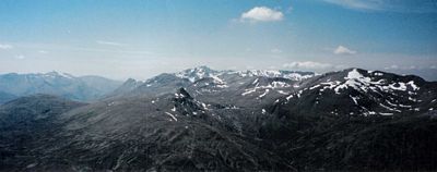
I carried on to the next peak and after a very steep zig-zag climb reached the top of Stob Coire Easain at 13.35. On the way I saw two ptarmigans on a snow bank and also three US Air Force F15s flying by practising their low-level flying - one of them was lower than me! (Unfortunately earlier this year two crashed on Ben Mcdui doing the same sort of thing in winter conditions - both pilots were killed and the bodies couldn't be recovered immediately because of the weather.) More great views in all directions but especially west towards the Grey Corries - but still lots of bugs and flies alas. It was a rocky summit with some snow banks.
Leaving the top at 13.55 via the north-west spur I made a steep descent over pink rock, zig-zagging down until it levelled out. There were lots of false paths then, which tended to lead to sheer sides so I plodded on instead, right to the end of the spur and then descended steeply again through heather - no trace of path but easy to see where I should be heading. Got to the valley bottom about 3.15 and it looked like a fair walk back - a good 4 miles. It was all fairly level from now on though and after a while I met up with the path by the riverside (the Allt Laire) just after the first patch of trees and it was straightforward from then on. After passing the second tree plantation the path joins the track of a dismantled tramway and, with the sun beating down on the back of your neck it's just a case of following that all the way back to the car park. (4.55) | ||||

 | ||||


