The South Shiel Ridge
Creag a Mhaim
Druim Shionnach
Aonach air Chrith
Maol Chinn-dearg
Sgurr an Doire Leathain
Sgurr an Lochain
Creag nan Damh
Map
I'd already done two of these hills, Aonach air Chrith and Maol Chinn-dearg, way back in
1991 (click on the link to see the comparative summit shots),
following Ralph Storer's '100 Best Routes on Scottish Mountains'. Now that I'd evolved into
a rabid munro-bagger, however, the lure of doing the entire 11 km ridge with its total of 7
mighty munros was not to be denied.
On top of which I had a glorious day for it and a wonderful wife to meet me with the car at
the other end so I wouldn't have to slog all the way back along the road.
We drove to the Cluanie Inn from Spean Bridge, where we were staying this week, and having
booted up I started off along the unclassified road there at 9.30, having told Trisha that the
walk would probably take me 9 hours: 2.5 hours to get to the first summit, 5 hours for the ridge
and 1.5 hours to get down. As I was putting my boots on a small blue car turned up and a bloke
got out, dumped his bike behind a hillock, said hello, then got back in his car and drove off.
I thought he must be going to do the ridge from west to east and then cycle back to his car - I
wondered if I'd meet him halfway.
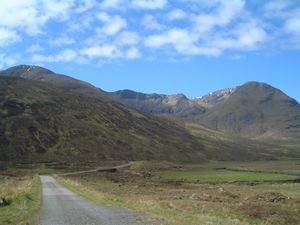
Starting off along the approach road
|
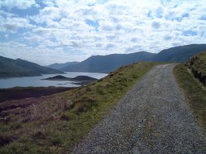
Loch Cluanie
|
I walked along the road for about 3 km and then where it turns sharply east I continued south
along a path through the heather and grass. There was a steepish rise ahead of me then a more
steady ascent following the distinct path up to the corrie below Creag a Mhaim. The ground was a
bit stonier there although still fairly grassy. A faint path seemed to lead off towards the northern
spur of the mountain but the way up there looked a bit craggy to me and so I took the guide book's
advice and slogged directly up the steep grassy hillside to the col. Then having gained the ridge
I turned left and it was an easy walk along the path to reach the summit soon after. (11.25 - making
good time, I thought).
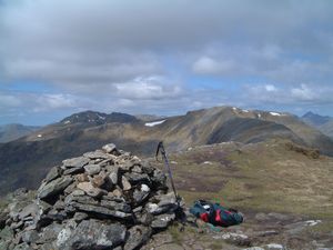
The South Glen Shiel Ridge from
the summit of Creag a Mhaim
|
From the top of Creag a Mhaim I had terrific views all round, especially of the ridge winding
its way west ahead of me. Earlier, while I'd been walking along the unclassified road, I'd been
followed by 3 people about ½ mile behind me but there was no sign of them now. I had also
overtaken a bloke on his own who, I noticed, had subsequently taken a different choice than
me at the corrie. He had gone for the northern spur approach - ignoring my wonderful example.
Bizarre, eh. I could see him now and he seemed to be making hard work of it. From the top the
route up the spur looked very steep and I was glad I'd gone the way I had.
From Creag a Mhaim I had an easy stroll along the ridge to the next munro, Druim Shionnach.
The way was wide enough at first but in the latter stages narrowed to a rocky knife-edge
with steep drops either side; not difficult but care was needed. There were silver sparkles
in the rocks and in the soil. I reached the summit at 12.10 and paused for a snack before
continuing on to Aonach air Chrith, the highest point of the ridge. No problems and I got
to the top at 1.15. There was a 70 year old bloke already there - Bernard Russell, a farmer
from Billericay. He had just climbed Maol Chinn-Dearg and Aonach air Chrith and was going
to return the same way. While we were chatting the chap I'd overtaken earlier arrived; he
was from Lancashire but living in Plockton and said this was his 51st munro. He was going
to do half the ridge that day.
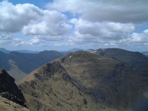
Maol Chinn-Dearg from Aonach air Chrith
|
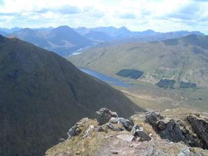
Narrow part of the ridge between
Aonach air Chrith and Maol Chinn-Dearg
|
From Aonach air Chrith I carried on along the path; some steep drops on my left and a few
interesting scrambly bits but nothing difficult. Got to the top of Maol Chinn-dearg at 2.30
and caught up with Plockton again there. After a chat he headed off down to the glen, feeling
he'd done enough for the day. Just then however, appropriately as it was the halfway point
munro-wise, the bike-dumper turned up from the other direction and we exchanged hellos for
the second time that day.
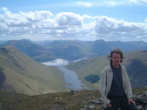
At the top of Maol Chinn-Dearg
with Loch Quoich behind
|
The next hill was Sgurr Coire na Feinne, a 902 metre eminence which I avoided by following
a well-trodden horizontal path etched into its southern flank. This led across to the slopes
of Sgurr an Doire Leathain whose 1010 metre summit was at the far end of a gracefully curving
horseshoe ridge, reached after an initially steepish climb over mud, grass and rock. A small,
scrappy cairn marked the top. (3.40) A couple arrived while I was there and took a picture for
me. There were some midges out now.
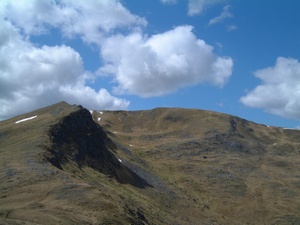
Sgurr an Doire Leathain
|
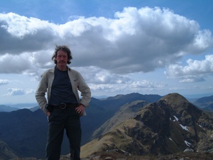
The couple's photo
|
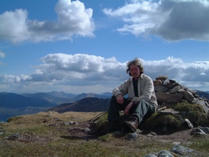
And then on Sgurr an Lochain
|
Next came the straightforward traverse over to the 6th munro, Sgurr an Lochain which I reached
at 16.20. Now I could look over to the final hill, Creag nan Damh, which appeared somewhat dark
and lowering at the time as a few clouds were floating by overhead. Still, it was simple enough
and I still felt in reasonable fettle considering this was the 7th munro of the day. I yomped
over and got to the top at 17.30 - a small cairn amidst grass and rocks on a wide, lumpy top.
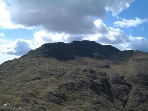
The final hill, Creag nan Damh
|
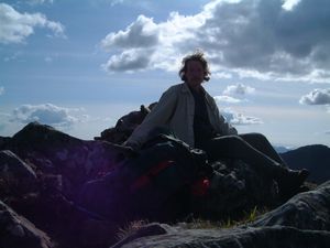
Taking a rest at the top of Creag nan Damh
|
I seem to have paused there a while for it was 17.50 before I set off down, and then I wasn't
too sure of the way - was I supposed to go due north over Sgurr a Chuilinn or slightly east
of north? I couldn't remember but thought it was probably the latter. I cast about for a while,
humming and haaing but in the end made the right decision. Rather than just ploughing ahead due
north I took the time to hunt around a bit for traces of a path and was duly rewarded to the NE.
I found a path and descended down a very steep hillside of earth, grass and crags, with the path
frequently disappearing. I dropped down as far as a stream and then found a path leading to the road.
It went through a forest at the end, with a very steep muddy stretch falling down through
trees to the road. At the bottom there was an annoying wire fence to get through - it had
a hole in it for the purpose but that forced you through some deep mud. Then gorze bushes
obstructed the final climb out to the road where Trisha was waiting, having been to
Eilean Donan and Plockton.
It was 19.30 now - an hour longer than my estimate, but I had
tended to spend a while at the summits.
Trisha had parked in the layby where the Battle of Glen Shiel had taken place in 1719.
Only one other car was there - a small blue one. Sure enough, as we drove off back
to Spean Bridge along the A87, a couple of miles further along I saw my old pal, the
bike-dumper, cycling towards us on his way back to his car.
|


